![](/images/other/stat-length.png)
![Trail Walking Le Vernet - 20190328_Le Vernet_Circuit des trois cabanes - Photo](https://media.geolcdn.com/t/1900/400/ext.pjpeg?maxdim=2&url=https%3A%2F%2Fmedia.geolcdn.com%2Ff%2F051351af-e906-4569-ae35-bad7f7d982c2.jpg)
20190328_Le Vernet_Circuit des trois cabanes
PapouBertrand
User
![Length](/images/other/stat-length.png)
![Max alt](https://static1.geolcdn.com/siteimages/upload/files/1508320355ic_sort_altitude_max_24dp.png)
![Uphill gradient](https://static1.geolcdn.com/siteimages/upload/files/1508320355ic_sort_den_pos_24dp.png)
![Km-Effort](/images/other/stat-length.png)
![Min alt](https://static1.geolcdn.com/siteimages/upload/files/1508320355ic_sort_altitude_min_24dp.png)
![Downhill gradient](https://static1.geolcdn.com/siteimages/upload/files/1508320355ic_sort_den_neg_24dp.png)
![Boucle](https://static1.geolcdn.com/siteimages/upload/files/16400158638029165_repeat_loop_refresh_sync_direction_icon.png)
![Walking](https://static1.geolcdn.com/sitytour/trail-icons/101.png)
4h18
Difficulty : Medium
![Scan this QR Code to open this trail in the SityTrail application](https://capi.geolives.com/qq0zvz2zws4bq2lad0pu/sitytour/trails/2053607/qr.png?size=200)
FREE GPS app for hiking
About
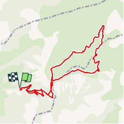
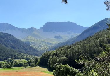
Trail Walking of 12.1 km to be discovered at Provence-Alpes-Côte d'Azur, Alpes-de-Haute-Provence, Le Vernet. This trail is proposed by PapouBertrand.
Description
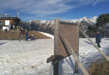
Randonnée réalisée fin mars 2019 avec le CSA de Gap (4e Régiment de Chasseurs).
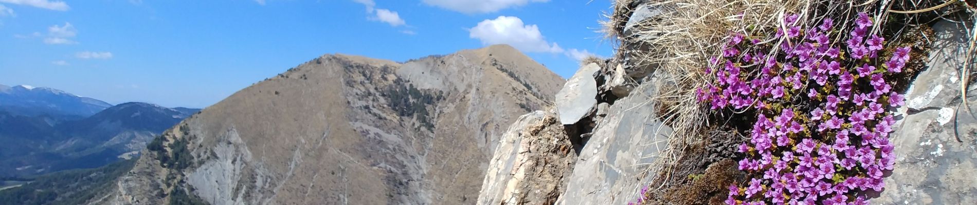
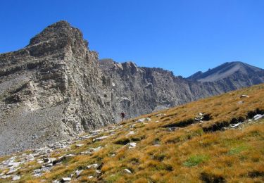
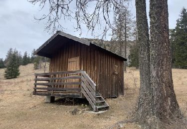
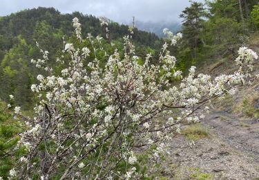
A quelques kilomètres de Seyne les Alpes, sur la commune du Vernet, très jolie randonnée de début de printemps de plus de 4 heures et d’environs 650 mètres de dénivelé au départ du parking du grand bois. Attention il y a une barrière qui interdit la montée au col de Mariaud en voiture. Pour accéder au col il est possible soit de suivre la piste forestière soit de couper les lacets. Nombreux Alpages et points de vue à 360 degrés. Nous avons aperçu des marmottes et des chamois aux abords de la cabane de Val Pousane.
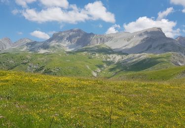
Très beau panorama au sommet du Pinet (1924 mètres).
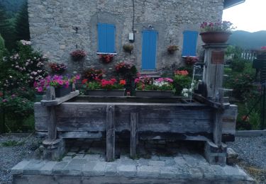
Sur le chemin du retour, juste avant d’arriver à la vielle cabane il y a une fontaine en bois en forme de vieux pressoir à raisin qui vaut le détour.
Aucune difficulté technique.
Positioning
Comments
Trails nearby
![Trail Walking Le Vernet - VERNET . col de Mariaud. Les 3 cabanes o - Photo](https://media.geolcdn.com/t/375/260/ext.jpg?maxdim=2&url=https%3A%2F%2Fstatic1.geolcdn.com%2Fsiteimages%2Fupload%2Ffiles%2F1553511878bg_sport_marche.png)
![Walking Walking](https://static1.geolcdn.com/sitytour/trail-icons/101.png)
Walking
![](/images/other/stat-length.png)
![](https://static1.geolcdn.com/siteimages/upload/files/16400158638029165_repeat_loop_refresh_sync_direction_icon.png)
![Trail Walking Prads-Haute-Bléone - Estrop par Pic des Têtes - Photo](https://media.geolcdn.com/t/375/260/ext.jpg?maxdim=2&url=https%3A%2F%2Fservices.sitytrail.com%2FGeolivesWS%2FDownloadMedia.ashx%3FTrailID%3D452152%26Media%3D673d9b5f-8851-4b41-9daf-25b8a44f9005.jpg)
![Walking Walking](https://static1.geolcdn.com/sitytour/trail-icons/101.png)
Walking
![](/images/other/stat-length.png)
![](https://static1.geolcdn.com/siteimages/upload/files/16400158638029165_repeat_loop_refresh_sync_direction_icon.png)
![Trail Walking Le Vernet - LE VERNET . COL DU MAL D HIVER . COL DU LABOURET . O L M - Photo](https://media.geolcdn.com/t/375/260/ext.jpg?maxdim=2&url=https%3A%2F%2Fmedia.geolcdn.com%2Ff%2Ff7633ca9-7d5b-44f5-917e-1ea1f5fb10ea.jpg)
![Walking Walking](https://static1.geolcdn.com/sitytour/trail-icons/101.png)
Walking
![](/images/other/stat-length.png)
![](https://static1.geolcdn.com/siteimages/upload/files/16400158638029165_repeat_loop_refresh_sync_direction_icon.png)
![Trail On foot Le Vernet - Boucle route des Béliers-Le col de Mariaud-Barre des Béliers-Col de la Grisonnière-Cabane du berger - Photo](https://media.geolcdn.com/t/375/260/ext.jpg?maxdim=2&url=https%3A%2F%2Fmedia.geolcdn.com%2Ff%2F2db42dd5-9a9c-4bfd-a26c-d699435386fb.jpg)
![On foot On foot](https://static1.geolcdn.com/sitytour/trail-icons/100.png)
On foot
![](/images/other/stat-length.png)
![](https://static1.geolcdn.com/siteimages/upload/files/16400158638029165_repeat_loop_refresh_sync_direction_icon.png)
![Trail On foot Le Vernet - AR Roussimal- Vieille cabane- Cabane des Têtes- Val pousane - Photo](https://media.geolcdn.com/t/375/260/ext.jpg?maxdim=2&url=https%3A%2F%2Fmedia.geolcdn.com%2Ff%2F209ef688-5571-4538-b76d-15017869ac6f.gif)
![On foot On foot](https://static1.geolcdn.com/sitytour/trail-icons/100.png)
On foot
![](/images/other/stat-length.png)
![](https://static1.geolcdn.com/siteimages/upload/files/16400158638029165_repeat_loop_refresh_sync_direction_icon.png)
![Trail On foot Le Vernet - Boucle Le Vernet-Le Haut Vernet-Le Vernet-Villevielle-Le Vernet - Photo](https://media.geolcdn.com/t/375/260/ext.jpg?maxdim=2&url=https%3A%2F%2Fmedia.geolcdn.com%2Ff%2Fb5b24fb4-ea33-4a35-899b-4bd1cd3e693f.jpg)
![On foot On foot](https://static1.geolcdn.com/sitytour/trail-icons/100.png)
On foot
![](/images/other/stat-length.png)
![](https://static1.geolcdn.com/siteimages/upload/files/16400158638029165_repeat_loop_refresh_sync_direction_icon.png)
![Trail Walking Seyne - Le Grand Puy 180222 - Photo](https://media.geolcdn.com/t/375/260/ext.jpg?maxdim=2&url=https%3A%2F%2Fmedia.geolcdn.com%2Ff%2Fcdc29ddf-b8f2-46f3-9a29-af63cea99181.jpg)
![Walking Walking](https://static1.geolcdn.com/sitytour/trail-icons/101.png)
Walking
![](/images/other/stat-length.png)
![](https://static1.geolcdn.com/siteimages/upload/files/16400158638029165_repeat_loop_refresh_sync_direction_icon.png)
![Trail Walking Le Vernet - 04 - Le Vernet - Circuit des 3 cabanes - Photo](https://media.geolcdn.com/t/375/260/ext.jpg?maxdim=2&url=https%3A%2F%2Fmedia.geolcdn.com%2Ff%2F5f4f6b68-410e-4665-831f-4d845dee5ed7.jpg)
![Walking Walking](https://static1.geolcdn.com/sitytour/trail-icons/101.png)
Walking
![](/images/other/stat-length.png)
![](https://static1.geolcdn.com/siteimages/upload/files/16400158638029165_repeat_loop_refresh_sync_direction_icon.png)
![Trail Walking Seyne - SEYNES LES ALPES . Grand puy , montagne de la Blache , cabane du Mulet o l s - Photo](https://media.geolcdn.com/t/375/260/ext.jpg?maxdim=2&url=https%3A%2F%2Fmedia.geolcdn.com%2Ff%2F0a85776d-4fbe-44a9-8b16-bf4257f31cc2.jpg)
![Walking Walking](https://static1.geolcdn.com/sitytour/trail-icons/101.png)
Walking
![](/images/other/stat-length.png)
![](https://static1.geolcdn.com/siteimages/upload/files/16400158638029165_repeat_loop_refresh_sync_direction_icon.png)